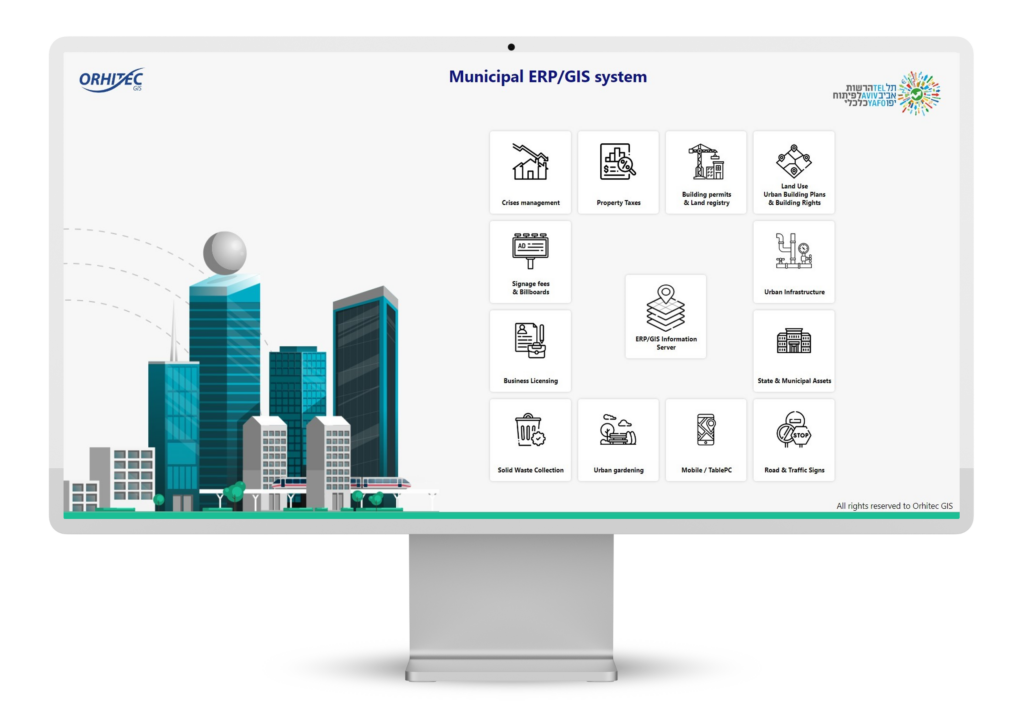
Orhitec GIS group develops and supplies smart city management systems and solutions using ERPGIS technology, for governments municipalities and diverse public entities.
We are built to provide end-to-end solutions, which also include data collection and geographic surveys, various types of maps and aerial photographs, customer support, implementation, and ongoing maintenance.


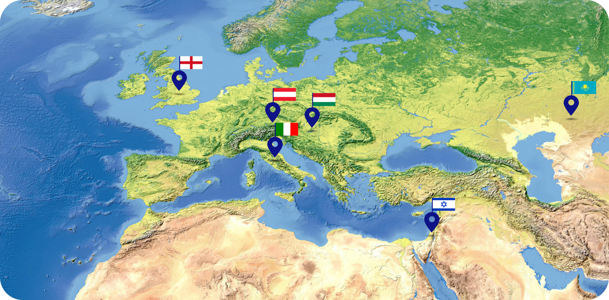
Orhitec GIS group Ltd. was founded in Israel by Mr. Barry Cohen in 1999 and has since been operating it’s GIS solutions in over 140 different governments and municipalities in several countries.
The company employs experts in all relevant professions for smart city management, such as software development, geographers, urban planners, civil engineers, architects, surveyors, real estate appraisers, lawyers specializing in planning and construction laws and property taxes etc. all under one roof.
This mix of professions allows the company a broad view and understanding of the government’s needs and the adaptation of the best solution to each type of requirement.