About Us

Control your city with Orhitec GIS Group

Orhitec GIS group Ltd. was founded in Israel by Mr. Barry Cohen in 1999 and has since been operating it’s GIS solutions in over 140 different governments and municipalities in several countries.

The company goal is to supply to its government customers high-tech and smart city solutions to the field of assets and infrastructures management, through the ability to analyze and control the information by GIS technologies. Over time, and along with customer requests, Orhitec has developed a complete basket of solutions for managing a smart city with GIS technologies.

Development

Orhitec GIS group employs experts for the development of GIS systems, civil and geodesy engineers, geographers, architects, real estate appraisers, lawyers, etc., who together provide a perfect solution for maximizing productivity and control over government systems.

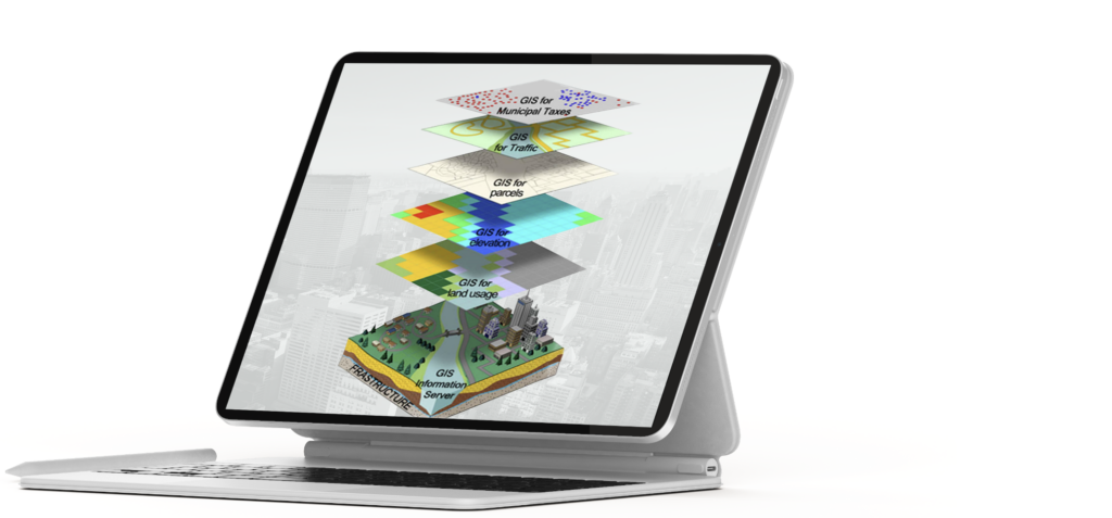
The company provide end-to-end solutions, and wide range of products and technologies, all under one stop shop and unique ERPGIS technology.

We use the following technologies to collect GIS and Engineering data

Geographic Information Systems and Data Collection

Our GIS applications and methodology are based on the following abilities and advantages:

Our ERPGIS technology:

For all of the above applications, and others, our company has developed an extensive set of stand-alone applications for data collection, data checking (quality control), data management, and many others

Our ERPGIS applications are based on universal platforms like AutodeskESRI &Geo server software, and Microsoft database.

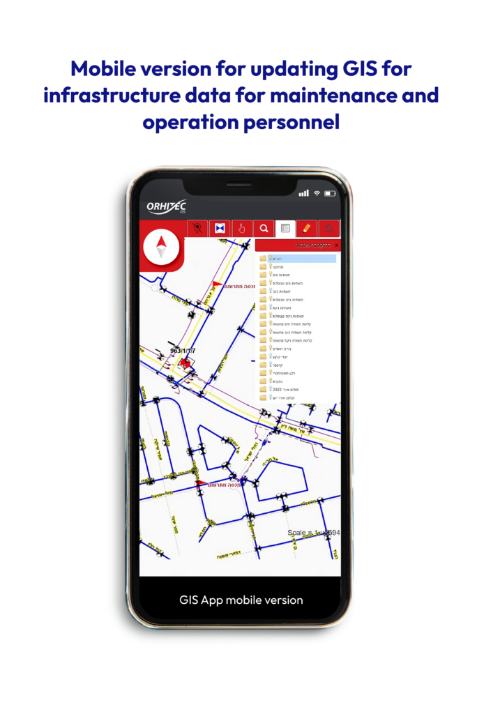
An extensive set of stand-alone applications for data collection, data checking (quality control), data management, and many others.

The user interface is customizable for various users, Internet and intranet, depending on the level of access to sensitive information.

Our development department can provide a user interface in any language required by the client.

User support and training for the GIS products to various clients.

Compliance with strict information security requirements, including the establishment of DR systems for functional continuity in an emergency.

All our applications can interface with other existing governmental programs such as billing applications, Property management, Land registration, Control and monitoring systems, etc.

Our systems are supplied as turnkey applications and can include hardware solutions, outsourcing to professional personnel, help desk, and others.

All the GIS applications were developed in accordance with the various users, such as decision makers, system administrators with the ability to perform graphic and alphanumeric updates, operational users, end users for viewing only etc.

Advantages and Capability of our ERPGIS as an Information Server

The solution that we developed is built as a modular system that includes ‘layers’ of different information by standalone applications, or all on one data warehouse, when each of the users in the different departments receives permission to view or update according to their field of use.

Our GIS applications can provide information to all kind of users in the government authorities, as well as to the civilian information consumers and public service.

One database that serves all the relevant bodies in the organization, also allows for quick, efficient and cheap updating, and saves a lot of money in collecting the information every time

The potential users of the system in the municipality are:

The use of orthophoto products for ERPGIS systems

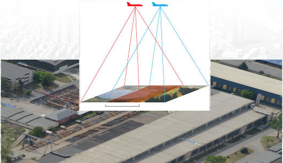
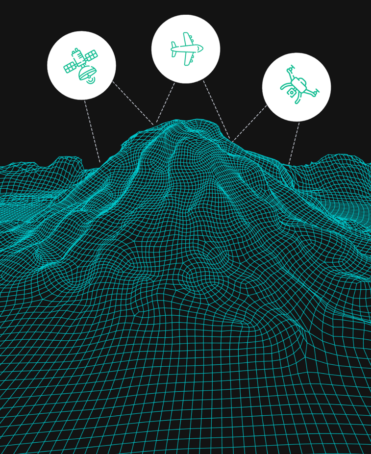
Geographic information can be collected by Orthophoto’s 2D\3D and field survey.

The geographic objects like properties or municipal infrastructure are positioned geographically using either Photogrammetric or Orthophotos maps. The use of one map as a basis for all the layers and the information collected for different purposes in the municipality, allows the construction of one database using the ERPGIS method, which is used by all departments and needs in the municipality or in the government office.

Short term advantages:

Increase tax revenue by enabling the municipality to constantly monitor properties and locate building and additions to buildings that are not currently on the tax records.
Create a system by which errors in taxation have occurred by cross-referencing field maps and field data. Likewise.
Reinforcing credibility of the municipality with the residents, and elevating the quality of service available to the residents by creating alert system and preventive maintenance in which problems are discovered before the residents are effected.
The GIS enables properties to be viewed on the aerial photograph (Orthophoto) or from the side if photographed in the field. This makes it much easier to verify information without bothering the resident.

Long term advantages:

Updating the properties. Superimposing a new Orthophoto on the existing map enables to discover cover changes like construction changes etc.
Without using a GIS, it is necessary to survey the entire geographic objects from scratch with all the attendant duplications and costs of a new survey.
Using a GIS enables the municipality to detect land use violations by superimposing the land use as specified by the town plan and the actual use as determined by the field survey.
One GIS database on a field cell allows the fertilization of information in the various departments of the authority.
Access to alphanumeric data in database format is available using computerized data management in GIS.
Information can be included in the GIS that will meet the future needs of the municipality.
All the above advantages translate into significant financial savings to the municipality and greatly improved service to the residents
Stay updated

Latest news

Orhitec GIS Ltd. won tender for conducting a municipal assets survey in Nazareth Municipality
  Orhitec GIS Ltd won tender for Urban Infrastructure management by ERPGIS technology in Givatayim Water and sewerage corporation
Orhitec GIS Ltd won tender for Urban Infrastructure management by ERPGIS technology in Modiin Regional Council