CRISES MANAGEMENT
Considering the global disasters around the world, such as earthquakes, fires, floods, terrorist attacks, wars, etc., the awareness of the importance of the authorities dealing with crises, and the acquisition of the necessary tools for this in the governmental and municipal sphere, has risen again.
Our company establishes and supplies the authorities a system for crises management and functional continuity in an emergency:
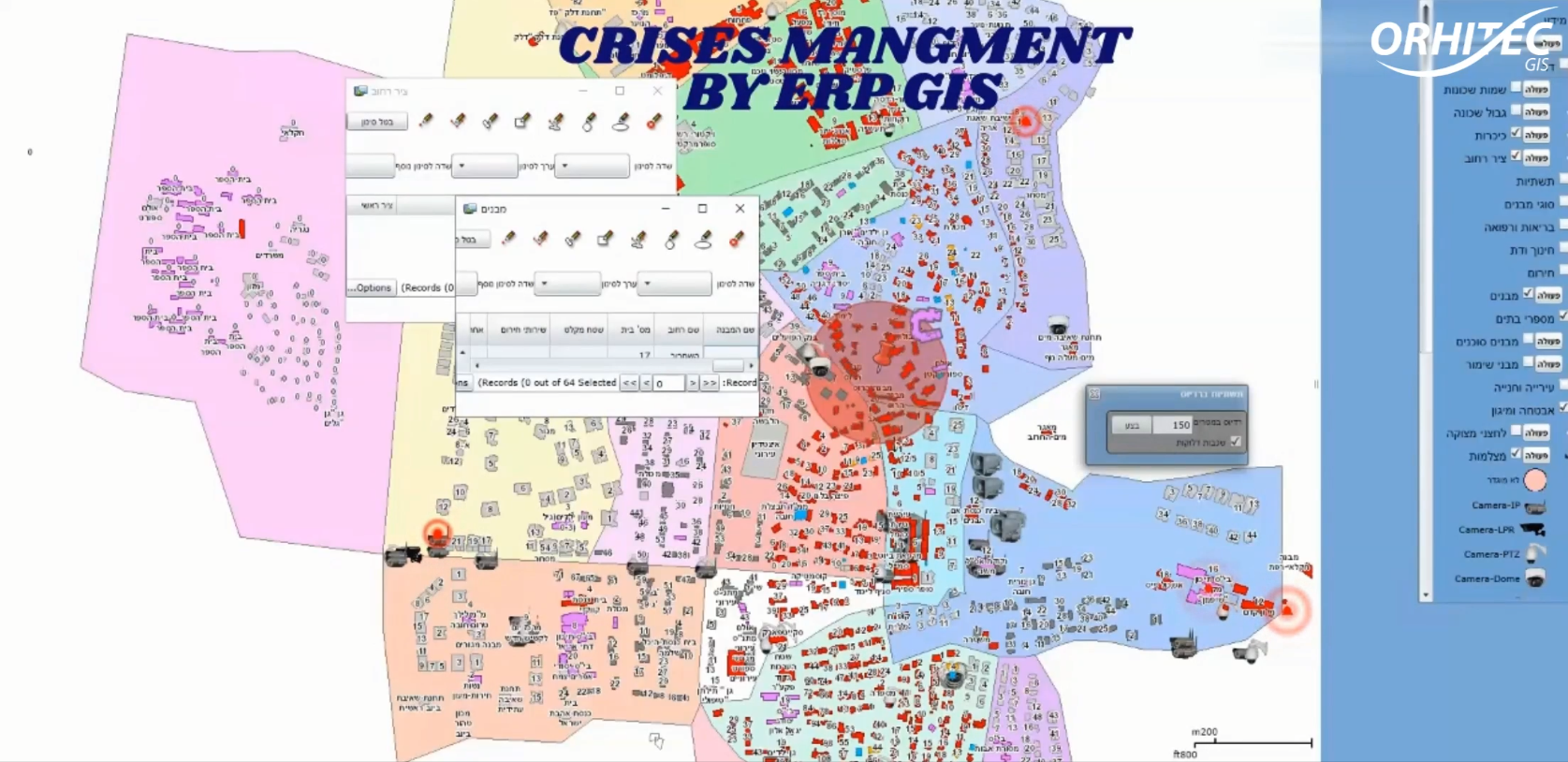
ERP\GIS FOR MUNICIPAL CRISES MANAGEMENT
The system can save lives! That’s right!
The system has been tested and implemented successfully and is recommended by the local authorities in cooperation with the Home Front Command and other emergency agencies such as the police, civil rescue services, firefighting, electricity and water supply, and more.
Below are some of the capabilities and characteristics of the system:
- Property management and population data in different sections and layers.
- Adaptation to the specifications of the Ministry of the Interior (functional continuity in an crises), Ministry of Internal Security, Ministry of housing and building, Ministry of national infrastructures, Ministry of transportation etc.
- Property segmentation at all levels, each floor / property in a separate layer, including floors and underground spaces.
- Ability to retrieve property and population in an area cell by polygon, address, block of land, to point to a building in an aerial photograph etc.
- The ability to retrieve the amount of assets in the building, owners/holder’s names of each asset, the number of persons and ages, BN\ID numbers, etc.
- The use and area of each property in the complex / building.
- The segmentation of the types of property uses according to all possible categories starting with residences, businesses – commerce/industry, and continuing in public institutions, educational institutions, dimensions, shelters, etc.
- Routine and crises infrastructure management – water, sewage, urban lighting, electricity, drainage and more.
- Interfaces to external systems such as: Command and Control Systems, the Water Authority, the Water and Sewerage Corporation, the Ministry of the Interior, the Ministry of Internal Affairs, etc.
- Interfaces to municipal systems such as vertical diagonal and 3D aerial photographs, planning and construction committee, municipal center, tax collection systems, welfare and more.
- Adapting the systems and interfaces to the information security procedures required by the national cyber system, the ISO 27001 standard, access permissions, etc..
- The system was developed on universal cloud and local platforms prevalent in the governmental and municipal sector – ESRI+AUTODESK+MICROSOFT, SQL database.