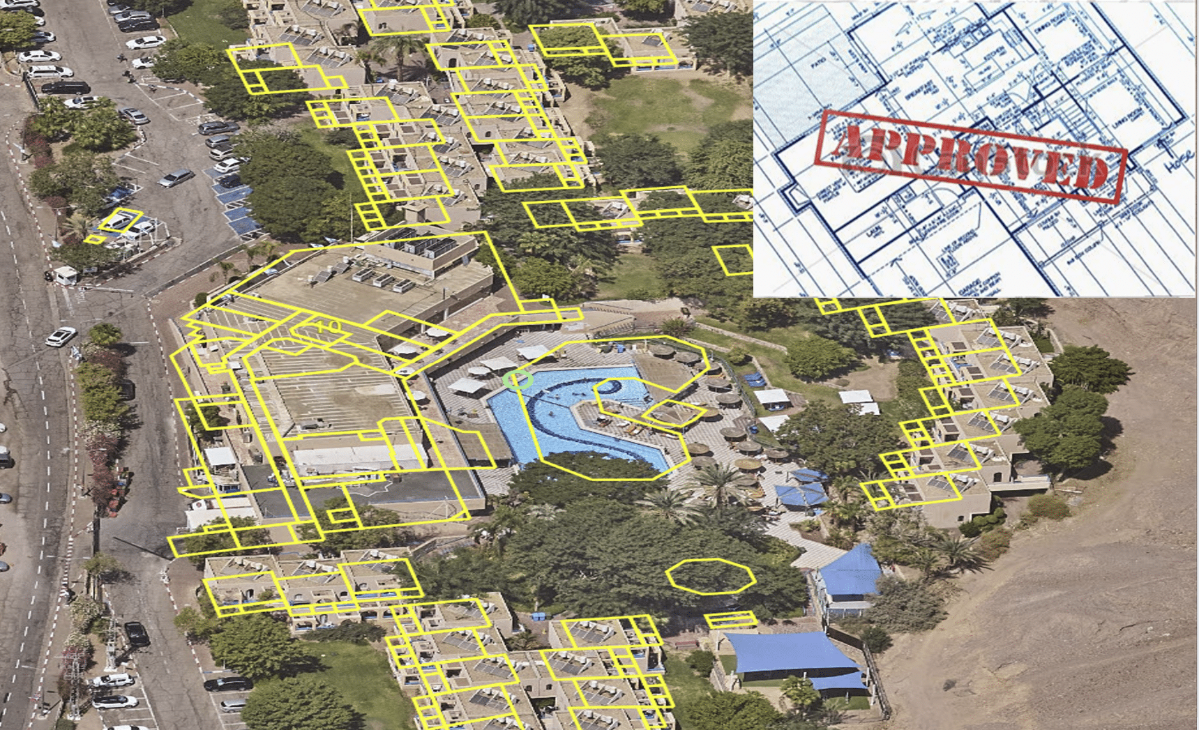
Business licensing management system with ERPGIS technology
A geographic survey and a business licensing management system using ERPGIS technology in the area of the Authority’s jurisdiction include the following:
- Conducting a field survey that includes information gathering of all the businesses properties in the city which require a business license.
- The survey in the field includes the collection and documentation of the information entered into the ERPGIS system including:
- Locating and geographical location of the businesses, including Address – Street name and building number, Block and Parcel, Neighborhood, Area, Coordinates.
- The name of the business owner.
- Photos of the business front and interior (subject to the consent of the business owner).
- Occupation group
- Occupation details
- The essence of the business and the description.
- The license certificates from the authority’s data or presented by the business owner to the inspector in the field.
- License No.
- License Status.
- The business owner/tenant.
- Signage survey data (in the signage fee survey)
- Tel/ Fax/email details.
- Interface to Property area in property tax/lot owner/lessor/property no.
- All survey data is absorbed into the dedicated information card of each property in the ERPGIS system.
- The system will include the possibility of generating structured reports in different sections for business licensing data in general, including for relevant assets that do not hold licensing as required, including the ability to attach photo documents (PDF, JPG, etc.), queries, export data to Excel, and more.