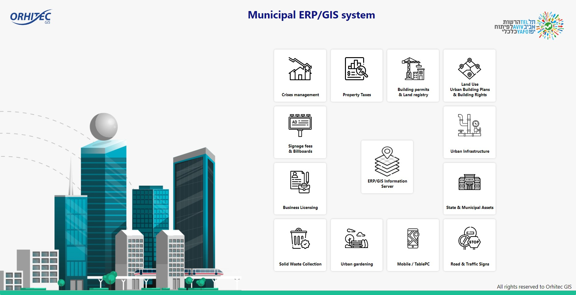
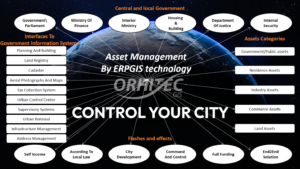
ERP/GIS Information Server
Developed as a modular system that includes Layers ‘of state\municipal geographic information. Our system is capable of providing geographic information to a different users, for urban, civil and security use. The significant advantage of our ERP\GIS is the ability to use one database that is used by all the different users in the organization, and when one party updates the data relevant to him, all other users in the org are updated automatically, under appropriate authorization. The ERP\GIS system serves the following areas and officials in the central local government such as:
- Decision makers – Ministers, Mayors, Directors, Commanders, etc.
- Municipal supervisors
- Crises management & emergency services
- Safe city services (Police, Firefighters, first aid, etc.)
- Asset management
- Property taxes
- City planners, Architects, land use & building registration
- Infrastructure management & engineers
- Transportation signs and traffic
- Education and public services.
- Business Registration
- Agriculture
- Urban gardening and irrigation
- Officials responsible for public improvements.
- Real estate investors
- Lawyers
- Real estate appraiser
- Tourists
- Local citizens
- Academic researchers in the fields of geography, economics, and engineering.