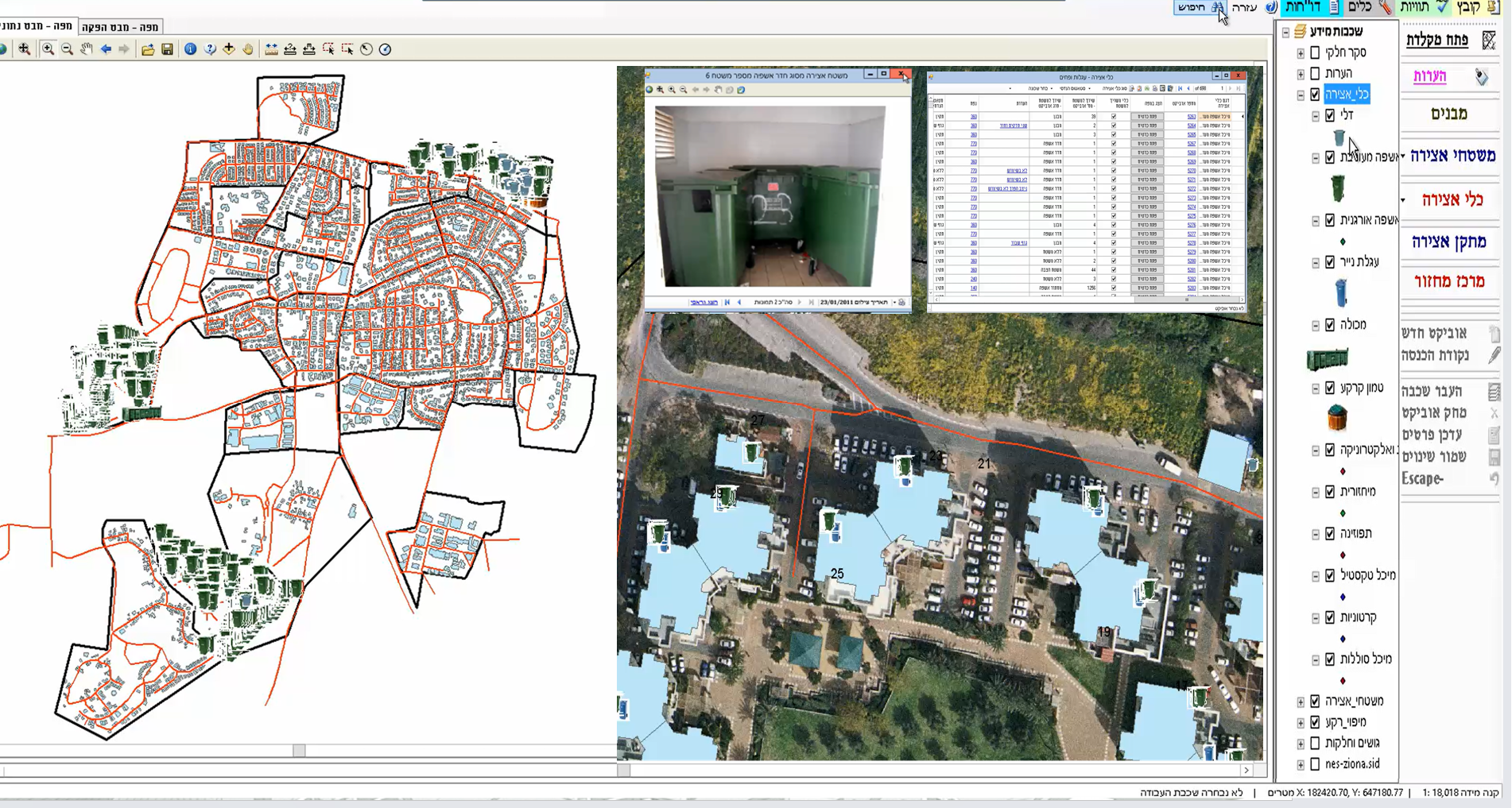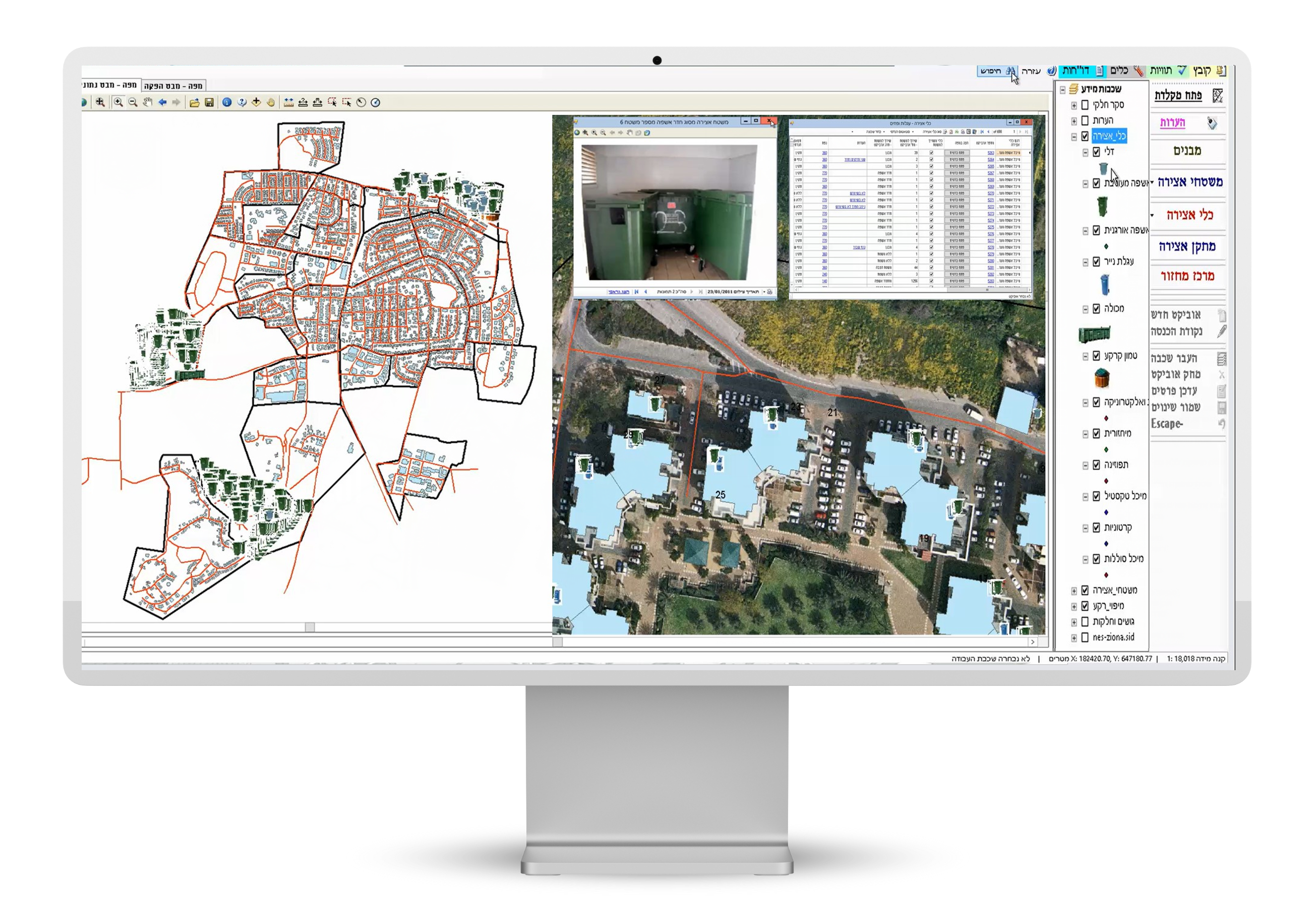
Solid Waste Collection and management by GIS technology
Orhitec’s GIS Solid Waste collection management system is used to plan collection routes.
For increasing the efficiency of public services while maximizing financial savings for the local authorities.
The GIS Module for managing the following data:
- Geographic notation for solid waste collection in residential and commercial locations helps in the optimization of planning.
- Planning the number and type of garbage collection bins needed in every building according to the number of apartments and the number of residents.
Enables the possibility of cross-checking apartment number data with every building in the GIS System. - For the management of the requests of residents for city financial aid in replacing or
repairing damaged garbage collection bins. - A system for end-users in the local authority that maintain all the above mentioned data.
A GIS system installed on PC Tablet computers, allows inspectors from the local authority to map data in the field for the following data:
- Collection of cut tree branches and trimmings only at places where it was left by the residents.
- A significant savings in the operating cost of collection trucks.
- Designation of the addresses of garbage bins that have been damaged for any reason and that require replacement.
- The module on the PC Tablet computer can update data in the installed system in the municipality by wireless or cellular communications from the field, or by updating information at the municipality offices upon the return of the inspectors from the field.
- The cost of establishing the system is considered to be inexpensive and worthwhile when compared to the value that the system offers.
Technology:
Our GIS applications are based on universal platforms like Autodesk & ESRI software, and the databases of Microsoft applications.
- An extensive set of stand-alone applications for data collection, data checking (quality control), data management, and many others.
- The user interface is customizable for various users, Internet and intranet, depending on the level of access to sensitive information.
- Our development department can provide a user interface in any language required by the client.
- All our applications can interface with existing programs such as land use, infrastructures management, Control, and monitoring systems, etc.
- Our systems are supplied as turnkey applications and can include hardware solutions, outsourcing to professional personnel, help desk, and others.
- User support and training for the GIS products to various clients.